The Eastern Mountain Piedmont area is divided into three physiographic provinces: the Blue Ridge, the Valley and Ridge, and the Appalachians. The Blue Ridge province is located in the northwestern corner of the piedmont and is made up of higher elevations and more rugged terrain. The Valley and Ridge province is located in the middle of the piedmont and has rolling hills and fertile valleys. The Appalachian province is located in the southeastern corner of the piedmont and has lower elevations and flatter terrain. Each province has its own unique climate, soils, plants, and animals. This data form provides detailed information about the Eastern Mountain Piedmont area.
| Question | Answer |
|---|---|
| Form Name | Eastern Mountains Piedmont Data Form |
| Form Length | 3 pages |
| Fillable? | No |
| Fillable fields | 0 |
| Avg. time to fill out | 45 sec |
| Other names | eastern mountains and piedmont wetland determination data form, wetland form eastern piedmont, data form piedmont, data form eastern mountains |

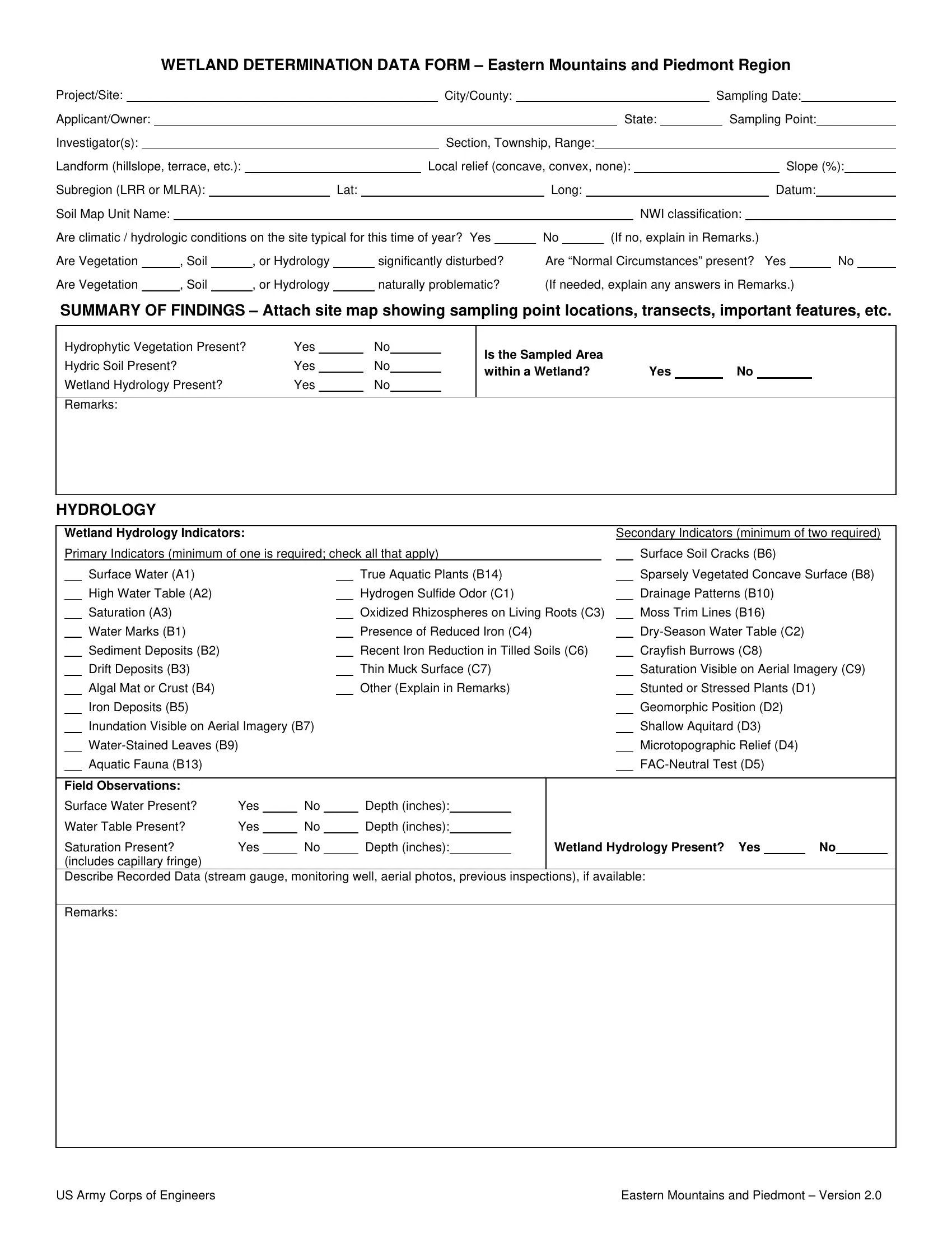
WETLAND DETERMINATION DATA FORM – Eastern Mountains and Piedmont Region
Project/Site: |
|
|
|
|
|
|
|
|
|
|
|
|
City/County: |
|
|
|
|
|
|
|
|
|
|
Sampling Date: |
|
|
|
|
|
|||||||||
Applicant/Owner: |
|
|
|
|
|
|
|
|
|
|
|
|
|
|
|
|
|
|
|
|
|
State: |
|
|
Sampling Point: |
|
|
|
|
|||||||||
Investigator(s): |
|
|
|
|
|
|
|
|
|
|
|
|
Section, Township, Range: |
|
|
|
|
|
|
|
|
|
|
|
|
|
|
|
|
|
||||||||
Landform (hillslope, terrace, etc.): |
|
|
|
|
|
|
Local relief (concave, convex, none): |
|
|
|
|
|
|
Slope (%): |
|
|||||||||||||||||||||||
Subregion (LRR or MLRA): |
|
|
|
Lat: |
|
|
|
|
|
|
|
Long: |
|
|
|
|
|
|
|
|
|
Datum: |
|
|
|
|
||||||||||||
Soil Map Unit Name: |
|
|
|
|
|
|
|
|
|
|
|
|
|
|
|
|
|
|
|
|
|
NWI classification: |
|
|
|
|
|
|
|
|
|
|
||||||
Are climatic / hydrologic conditions on the site typical for this time of year? Yes |
|
|
No |
|
|
(If no, explain in Remarks.) |
|
|
|
|
|
|
|
|
|
|||||||||||||||||||||||
Are Vegetation |
|
|
, Soil |
|
|
, or Hydrology |
|
|
significantly disturbed? |
|
|
Are “Normal Circumstances” present? |
Yes |
|
|
No |
|
|||||||||||||||||||||
Are Vegetation |
|
|
, Soil |
|
|
, or Hydrology |
|
|
naturally problematic? |
|
|
(If needed, explain any answers in Remarks.) |
|
|
|
|
||||||||||||||||||||||
SUMMARY OF FINDINGS – Attach site map showing sampling point locations, transects, important features, etc.
Hydrophytic Vegetation Present? |
Yes |
|
No |
|
|
Is the Sampled Area |
|
|
|
|
|
Hydric Soil Present? |
Yes |
|
No |
|
|
|
|
No |
|||
|
|
|
within a Wetland? |
Yes |
|
||||||
Wetland Hydrology Present? |
Yes |
|
No |
|
|
|
|||||
|
|
|
|
|
|
|
|
|
|||
|
|
|
|
|
|
|
|
|
|
|
|
Remarks:
HYDROLOGY
|
Wetland Hydrology Indicators: |
|
|
|
|
|
|
|
|
|
|
Secondary Indicators (minimum of two required) |
|
|||||||
|
Primary Indicators (minimum of one is required; check all that apply) |
|
|
|
Surface Soil Cracks (B6) |
|
|
|
||||||||||||
|
|
Surface Water (A1) |
|
|
|
|
|
|
True Aquatic Plants (B14) |
|
|
|
Sparsely Vegetated Concave Surface (B8) |
|
||||||
|
|
High Water Table (A2) |
|
|
|
|
|
|
Hydrogen Sulfide Odor (C1) |
|
|
|
Drainage Patterns (B10) |
|
|
|
||||
|
|
Saturation (A3) |
|
|
|
|
|
|
Oxidized Rhizospheres on Living Roots (C3) |
|
Moss Trim Lines (B16) |
|
|
|
||||||
|
|
Water Marks (B1) |
|
|
|
|
|
|
Presence of Reduced Iron (C4) |
|
|
|
|
|
|
|||||
|
|
Sediment Deposits (B2) |
|
|
|
|
|
|
Recent Iron Reduction in Tilled Soils (C6) |
|
Crayfish Burrows (C8) |
|
|
|
||||||
|
|
Drift Deposits (B3) |
|
|
|
|
|
|
Thin Muck Surface (C7) |
|
|
|
Saturation Visible on Aerial Imagery (C9) |
|
||||||
|
|
Algal Mat or Crust (B4) |
|
|
|
|
|
|
Other (Explain in Remarks) |
|
|
|
Stunted or Stressed Plants (D1) |
|
|
|
||||
|
|
Iron Deposits (B5) |
|
|
|
|
|
|
|
|
|
|
|
|
Geomorphic Position (D2) |
|
|
|
||
|
|
Inundation Visible on Aerial Imagery (B7) |
|
|
|
|
|
|
|
|
Shallow Aquitard (D3) |
|
|
|
||||||
|
|
|
|
|
|
|
|
|
|
|
|
|
Microtopographic Relief (D4) |
|
|
|
||||
|
|
Aquatic Fauna (B13) |
|
|
|
|
|
|
|
|
|
|
|
|
|
|
|
|||
|
|
|
|
|
|
|
|
|
|
|
|
|
|
|
|
|
|
|
|
|
|
Field Observations: |
|
|
|
|
|
|
|
|
|
|
|
|
|
|
|
|
|
|
|
|
Surface Water Present? |
Yes |
|
No |
|
|
|
Depth (inches): |
|
|
|
|
|
|
|
|
|
|
|
|
|
Water Table Present? |
Yes |
|
No |
|
|
|
Depth (inches): |
|
|
|
|
|
|
|
|
|
|
|
|
|
Saturation Present? |
Yes |
|
No |
|
|
Depth (inches): |
Wetland Hydrology Present? Yes |
No |
|
||||||||||
|
(includes capillary fringe) |
|
|
|
|
|
|
|
|
|
|
|
|
|
|
|
|
|
|
|
Describe Recorded Data (stream gauge, monitoring well, aerial photos, previous inspections), if available:
Remarks:
US Army Corps of Engineers |
Eastern Mountains and Piedmont – Version 2.0 |
VEGETATION (Four Strata) – Use scientific names of plants. |
Sampling Point:____________ |
|
|
|
|
|
|
|
|
|
|
|
|
Absolute |
Dominant |
Indicator |
||||||
Tree Stratum (Plot size: |
) |
|
|
|
|
|
% Cover |
Species? |
|
|
Status |
|||||||||
1. |
|
|
|
|
|
|
|
|
|
|
|
|
|
|
|
|
|
|
|
|
2. |
|
|
|
|
|
|
|
|
|
|
|
|
|
|
|
|
|
|
|
|
3. |
|
|
|
|
|
|
|
|
|
|
|
|
|
|
|
|
|
|
|
|
4. |
|
|
|
|
|
|
|
|
|
|
|
|
|
|
|
|
|
|
|
|
5. |
|
|
|
|
|
|
|
|
|
|
|
|
|
|
|
|
|
|
|
|
6. |
|
|
|
|
|
|
|
|
|
|
|
|
|
|
|
|
|
|
|
|
7. |
|
|
|
|
|
|
|
|
|
|
|
|
|
|
|
|
|
|
|
|
|
|
|
|
|
|
|
|
|
|
|
|
|
|
|
= Total Cover |
|||||
|
|
|
|
50% of total cover: |
|
|
|
|
|
20% of total cover: |
|
|
|
|
||||||
Sapling/Shrub Stratum (Plot size: |
) |
|
|
|
|
|
|
|
|
|
|
|||||||||
1. |
|
|
|
|
|
|
|
|
|
|
|
|
|
|
|
|
|
|
|
|
2. |
|
|
|
|
|
|
|
|
|
|
|
|
|
|
|
|
|
|
|
|
3. |
|
|
|
|
|
|
|
|
|
|
|
|
|
|
|
|
|
|
|
|
4. |
|
|
|
|
|
|
|
|
|
|
|
|
|
|
|
|
|
|
|
|
5. |
|
|
|
|
|
|
|
|
|
|
|
|
|
|
|
|
|
|
|
|
6. |
|
|
|
|
|
|
|
|
|
|
|
|
|
|
|
|
|
|
|
|
7. |
|
|
|
|
|
|
|
|
|
|
|
|
|
|
|
|
|
|
|
|
8. |
|
|
|
|
|
|
|
|
|
|
|
|
|
|
|
|
|
|
|
|
9. |
|
|
|
|
|
|
|
|
|
|
|
|
|
|
|
|
|
|
|
|
|
|
|
|
|
|
|
|
|
|
|
|
|
|
|
= Total Cover |
|||||
|
|
|
|
50% of total cover: |
|
|
|
|
|
20% of total cover: |
|
|
|
|
||||||
Herb Stratum (Plot size: |
) |
|
|
|
|
|
|
|
|
|
|
|
|
|
|
|||||
1. |
|
|
|
|
|
|
|
|
|
|
|
|
|
|
|
|
|
|
|
|
2. |
|
|
|
|
|
|
|
|
|
|
|
|
|
|
|
|
|
|
|
|
3. |
|
|
|
|
|
|
|
|
|
|
|
|
|
|
|
|
|
|
|
|
4. |
|
|
|
|
|
|
|
|
|
|
|
|
|
|
|
|
|
|
|
|
5. |
|
|
|
|
|
|
|
|
|
|
|
|
|
|
|
|
|
|
|
|
6. |
|
|
|
|
|
|
|
|
|
|
|
|
|
|
|
|
|
|
|
|
7. |
|
|
|
|
|
|
|
|
|
|
|
|
|
|
|
|
|
|
|
|
8. |
|
|
|
|
|
|
|
|
|
|
|
|
|
|
|
|
|
|
|
|
9. |
|
|
|
|
|
|
|
|
|
|
|
|
|
|
|
|
|
|
|
|
10. |
|
|
|
|
|
|
|
|
|
|
|
|
|
|
|
|
|
|
|
|
11. |
|
|
|
|
|
|
|
|
|
|
|
|
|
|
|
|
|
|
|
|
|
|
|
|
|
|
|
|
|
|
|
|
|
|
|
= Total Cover |
|||||
|
|
|
|
50% of total cover: |
|
|
|
|
|
20% of total cover: |
|
|
|
|
||||||
Woody Vine Stratum (Plot size: |
|
|
|
|
) |
|
|
|
|
|
|
|
|
|
|
|
||||
1. |
|
|
|
|
|
|
|
|
|
|
|
|
|
|
|
|
|
|
|
|
2. |
|
|
|
|
|
|
|
|
|
|
|
|
|
|
|
|
|
|
|
|
3. |
|
|
|
|
|
|
|
|
|
|
|
|
|
|
|
|
|
|
|
|
4. |
|
|
|
|
|
|
|
|
|
|
|
|
|
|
|
|
|
|
|
|
5. |
|
|
|
|
|
|
|
|
|
|
|
|
|
|
|
|
|
|
|
|
|
|
|
|
|
|
|
|
|
|
|
|
|
|
|
= Total Cover |
|||||
|
|
|
|
50% of total cover: |
|
|
|
|
|
20% of total cover: |
|
|
|
|
||||||
|
Dominance Test worksheet: |
|
|
|
|
|
|
|
|
||
|
Number of Dominant Species |
|
|
|
|
|
|
|
|
||
|
That Are OBL, FACW, or FAC: |
|
(A) |
||||||||
|
Total Number of Dominant |
|
|
|
|
|
|
|
|
||
|
Species Across All Strata: |
|
|
|
|
|
|
(B) |
|||
|
Percent of Dominant Species |
|
|
|
|
|
|
|
|
||
|
That Are OBL, FACW, or FAC: |
|
|
(A/B) |
|||||||
|
|
|
|
|
|||||||
|
Prevalence Index worksheet: |
|
|
|
|||||||
|
Total % Cover of: |
|
|
|
Multiply by: |
|
|
|
|
||
|
OBL species |
|
|
|
x 1 = |
|
|
|
|
||
|
FACW species |
|
|
|
x 2 = |
|
|
|
|
||
|
FAC species |
|
|
|
x 3 = |
|
|
|
|
||
|
FACU species |
|
|
|
x 4 = |
|
|
|
|
||
|
UPL species |
|
|
|
x 5 = |
|
|
|
|
||
|
Column Totals: |
|
|
(A) |
|
|
|
(B) |
|||
Prevalence Index = B/A =
Hydrophytic Vegetation Indicators:
1 - Rapid Test for Hydrophytic Vegetation
2 - Dominance Test is >50%
3 - Prevalence Index is ≤3.01
4 - Morphological Adaptations1 (Provide supporting
data in Remarks or on a separate sheet) Problematic Hydrophytic Vegetation1 (Explain)
1Indicators of hydric soil and wetland hydrology must be present, unless disturbed or problematic.
Definitions of Four Vegetation Strata:
Tree – Woody plants, excluding vines, 3 in. (7.6 cm) or more in diameter at breast height (DBH), regardless of height.
Sapling/Shrub – Woody plants, excluding vines, less than 3 in. DBH and greater than or equal to 3.28 ft (1 m) tall.
Herb – All herbaceous
Woody vine – All woody vines greater than 3.28 ft in height.
Hydrophytic |
|
|
Vegetation |
|
|
Present? |
Yes |
No |
Remarks: (Include photo numbers here or on a separate sheet.)
US Army Corps of Engineers |
Eastern Mountains and Piedmont – Version 2.0 |

SOIL |
Sampling Point: |
Profile Description: (Describe to the depth needed to document the indicator or confirm the absence of indicators.)
Depth |
Matrix |
|
|
|
|
Redox Features |
|
|
|
|
|
|
|
|
|
|
|
||||||
(inches) |
Color (moist) |
% |
|
|
Color (moist) |
% |
|
|
Type1 |
|
|
|
Loc2 |
|
|
Texture |
|
Remarks |
|||||
|
|
|
|
|
|
|
|
|
|
|
|
|
|
|
|
|
|
|
|
|
|
|
|
|
|
|
|
|
|
|
|
|
|
|
|
|
|
|
|
|
|
|
|
|
|
|
|
|
|
|
|
|
|
|
|
|
|
|
|
|
|
|
|
|
|
|
|
|
|
|
|
|
|
|
|
|
|
|
|
|
|
|
|
|
|
|
|
|
|
|
|
|
|
|
|
|
|
|
|
|
|
|
|
|
|
|
|
|
|
|
|
|
|
|
|
|
|
|
|
|
|
|
|
|
|
|
|
|
|
|
|
|
|
|
|
|
|
|
|
|
|
|
|
|
|
|
|
|
|
|
|
|
|
|
|
|
|
|
|
|
|
|
|
|
|
|
|
|
|
|
|
|
|
|
|
|
|
|
|
|
|
|
|
|
|
|
|
|
|
|
|
|
|
|
|
|
|
|
|
|
|
|
|
|
|
|
|
|
|
|
|
|
|
|
|
|
|
|
|
|
|
|
|
|
|
|
|
|
|
|
|
|
|
|
|
|
|
|
|
|
1Type: C=Concentration, D=Depletion, RM=Reduced Matrix, MS=Masked Sand Grains. |
2Location: PL=Pore Lining, M=Matrix. |
|
|
|
|||||||||||
|
Hydric Soil Indicators: |
|
|
|
|
|
Indicators for Problematic Hydric Soils3: |
|||||||||
|
|
Histosol (A1) |
|
|
Dark Surface (S7) |
|
|
2 cm Muck (A10) (MLRA 147) |
||||||||
|
|
Histic Epipedon (A2) |
|
|
Polyvalue Below Surface (S8) (MLRA 147, 148) |
|
Coast Prairie Redox (A16) |
|
|
|
||||||
|
|
Black Histic (A3) |
|
|
Thin Dark Surface (S9) (MLRA 147, 148) |
|
|
(MLRA 147, 148) |
|
|
|
|||||
|
|
Hydrogen Sulfide (A4) |
|
|
Loamy Gleyed Matrix (F2) |
|
|
Piedmont Floodplain Soils (F19) |
||||||||
|
|
Stratified Layers (A5) |
|
|
Depleted Matrix (F3) |
|
|
(MLRA 136, 147) |
|
|
|
|||||
|
|
2 cm Muck (A10) (LRR N) |
|
|
Redox Dark Surface (F6) |
|
|
Very Shallow Dark Surface (TF12) |
||||||||
|
|
Depleted Below Dark Surface (A11) |
|
|
Depleted Dark Surface (F7) |
|
|
Other (Explain in Remarks) |
|
|
|
|||||
|
|
Thick Dark Surface (A12) |
|
|
Redox Depressions (F8) |
|
|
|
|
|
|
|
|
|||
|
|
Sandy Mucky Mineral (S1) (LRR N, |
|
|
|
|
|
|
|
|
|
|
||||
|
|
MLRA 147, 148) |
|
|
MLRA 136) |
|
|
|
|
|
|
|
|
|||
|
|
Sandy Gleyed Matrix (S4) |
|
|
Umbric Surface (F13) (MLRA 136, 122) |
|
3Indicators of hydrophytic vegetation and |
|||||||||
|
|
Sandy Redox (S5) |
|
|
Piedmont Floodplain Soils (F19) (MLRA 148) |
|
wetland hydrology must be present, |
|||||||||
|
|
Stripped Matrix (S6) |
|
|
Red Parent Material (F21) (MLRA 127, 147) |
|
|
unless disturbed or problematic. |
||||||||
|
|
|
|
|
|
|
|
|
|
|
|
|
|
|||
|
Restrictive Layer (if observed): |
|
|
|
|
|
|
|
|
|
|
|
|
|||
|
|
Type: |
|
|
|
|
|
|
|
|
|
|
|
|
|
|
|
|
Depth (inches): |
|
|
|
|
Hydric Soil Present? Yes |
No |
||||||||
|
|
|
|
|
|
|
|
|
|
|
|
|
|
|||
|
Remarks: |
|
|
|
|
|
|
|
|
|
|
|
|
|||
US Army Corps of Engineers |
Eastern Mountains and Piedmont – Version 2.0 |