
To fill out Wisconsin DNR Form 3500-053, use our free online PDF tool. No software installation is needed. Follow these steps to complete the form:
Step 1: Click the "Get Form" button at the top of this page to open the form in our online editor.
Step 2: Once the editor opens, the form is ready to fill. You can complete blank fields, add text, insert images, and sign the PDF directly in your browser.
Take care when completing each section of the form. All required fields must be filled accurately.
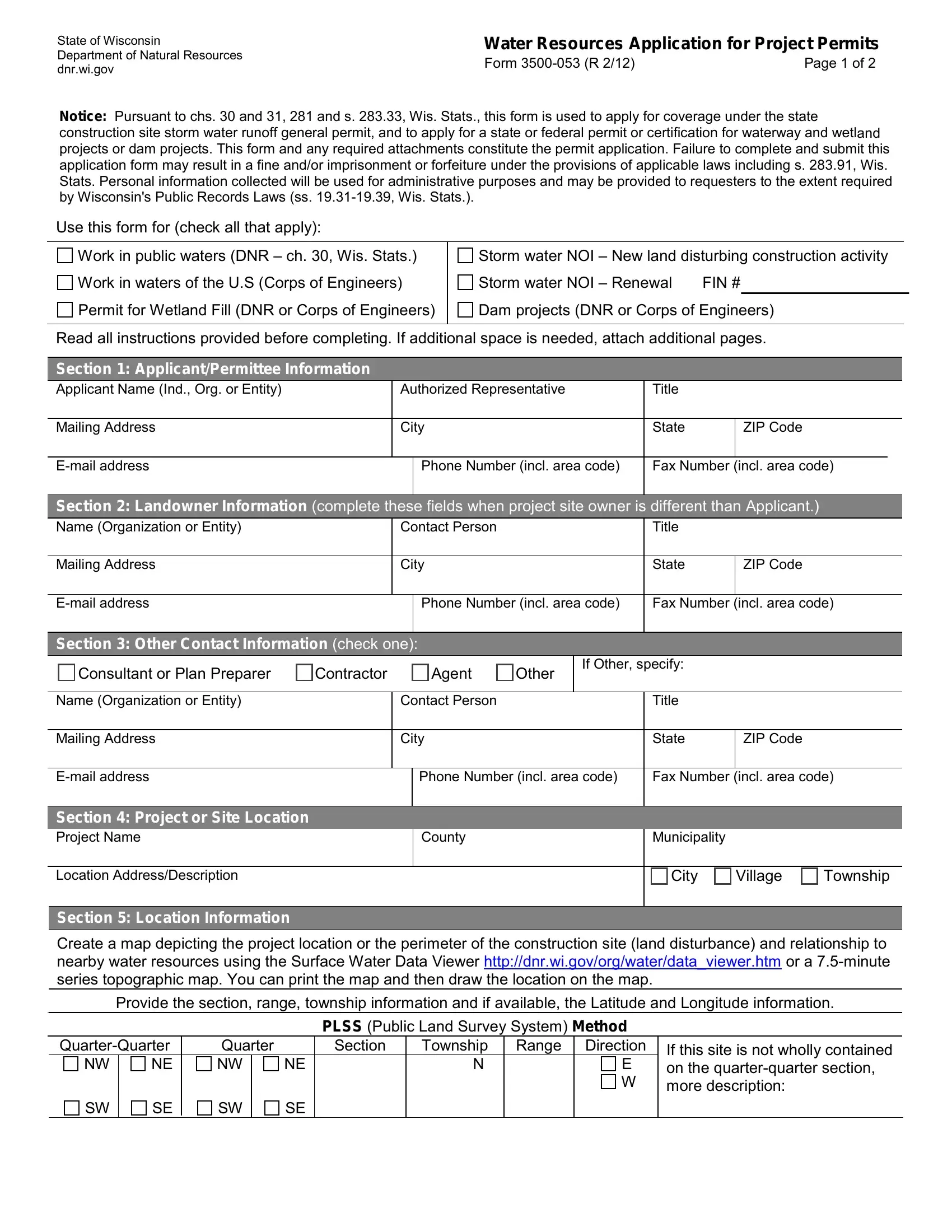
1. Complete the applicant information sections carefully, including the following fields:
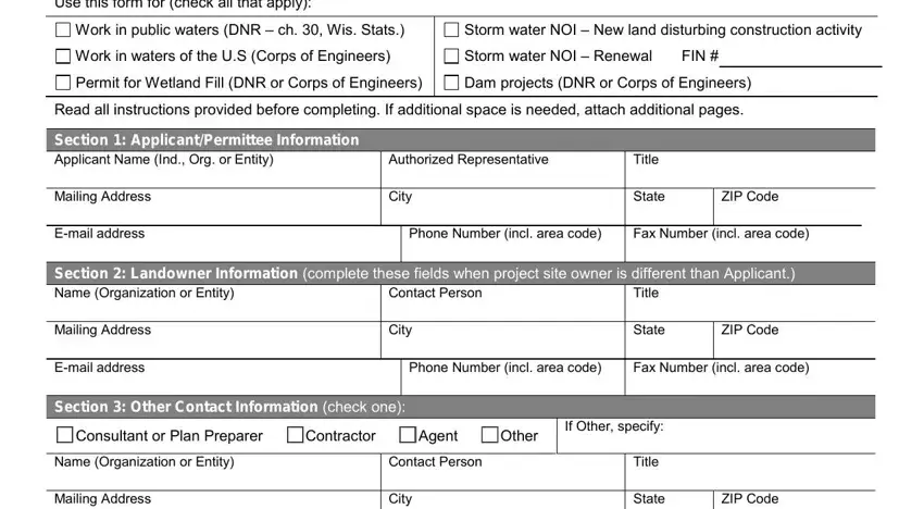
2. Enter the agent contact information, including: Agent Contact Person, City, Phone Number, Name or Organization, Title, State, Fax Number, Municipality, ZIP Code, County, Township, and Village.
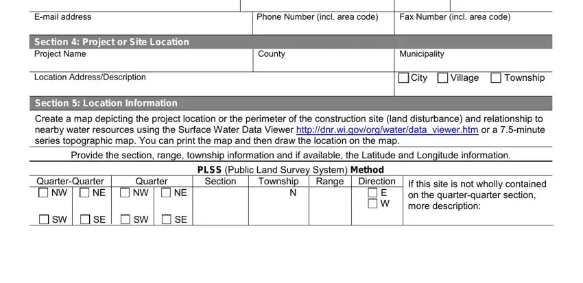
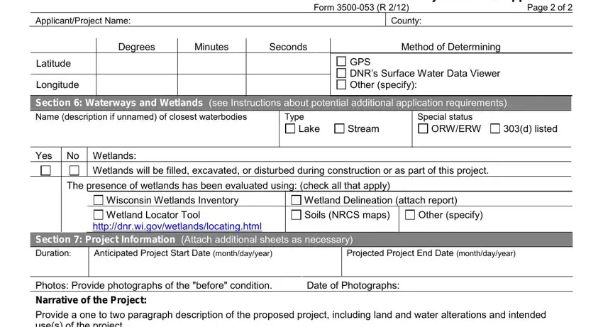
3. Complete the project location and water resources section, including: Applicant/Project Name, Latitude, Degrees, Minutes, Seconds, County, Method of Determining Coordinates (GPS or DNR Surface Water Data Viewer), Longitude, Waterways, ORWERW designation, Special Status, Lake or Stream name, and Type.
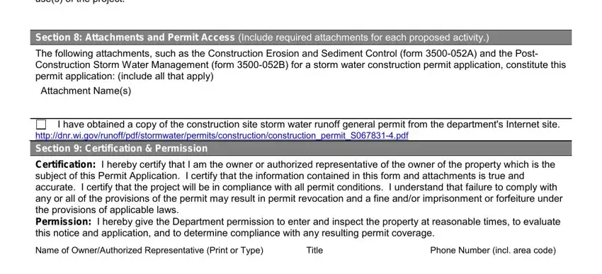
4. Fill in the attachments and final declarations section, including: Photos of the project area, Attachments and Permit section, confirmation that you have obtained a copy of the applicable rules, your Phone Number, and Title.
Step 3: Review all entries carefully and click "Done." Start a free 7-day trial to download, email, or edit your completed Wisconsin DNR Form 3500-053 from your FormsPal account. FormsPal does not share information you enter while completing forms.