Bmp Plan Form PDF Details

A BMP plan form is a document prepared by a property owner or their agent that describes the proposed Best Management Practices (BMPs) to be implemented at a specific site. The form must include, at a minimum, a description of the pollutants associated with stormwater runoff from the property, and the proposed management practices to control and reduce those pollutants. Properties subject to this requirement are typically those that are: within 100 feet of a stream; have more than one acre of impervious surface; or discharge more than 10,000 gallons of stormwater runoff per year. If you're unsure whether your property falls within these parameters, please contact your local permitting authority for clarification. A well-executed BMP plan can help you avoid

QuestionAnswer
Form NameBmp Plan Form
Form Length42 pages
Fillable?No
Fillable fields0
Avg. time to fill out10 min 30 sec
Other namesbmp template, bmp plan alabama, plan bmp get, bmp plans

Form Preview Example

Small Noncoal/Nonmetallic Mining Best Management Practices Plan (BMP Plan)

Instructions

To help you develop the narrative section of your small mining site BMP Plan, the Alabama Department of Environmental Management (ADEM) has created this electronic BMP Plan template. The template is designed to help guide you through the BMP Plan development process and help ensure that your BMP Plan addresses all the necessary elements for a complete application. You should use this template (available at www.adem.alabama.gov) with the Alabama Handbook for Erosion Control, Sediment Control and Stormwater Management on Construction Sites and Urban Areas March 2009 Edition. The handbook is available at http://swcc.alabama.gov/pages/erosion_control.aspx?sm=b_b.

You are required by Part III.D of the Small Noncoal/Nonmetallic Mining General Permit ALG890000 to develop a BMP Plan which reflects the requirements of the permit, as well as the conditions at your site. This template is intended to be used as a guide in development of your site’s BMP Plan, thus it should be customized for your site.

Using the BMP Plan Template

Each section of this template includes “instructions” and space for project information. You should read the instructions for each section before you complete that section. This template is available in Word format if requested. The header can be customized to allow you to insert your own company logo. Some sections may require only a brief description while others may require several pages of explanation.

Prior to printing and submitting your BMP Plan, delete all instructions.

Tips for completing the BMP Plan Template

Modify this BMP Plan template so that it addresses the requirements of the Small Noncoal/Nonmetallic Mining General Permit and meets the needs of your project. Consider adding permit citations in the BMP Plan when you address a specific permit requirement(s).

In accordance with Part III.A.7 of the permit, the Permittee is required to implement measures or requirements to achieve the pollutant reductions consistent with a TMDL finalized or approved by EPA. Applicable TMDLs are located and/or can be accessed at http://www.adem.alabama.gov/programs/water/approvedTMDLs.htm

In accordance with Part III.A.8 of the permit, the Permittee is required to implement measures or requirements to ensure that discharges will not cause or contribute to the listed impairment for those waters listed on the most recently approved 303(d) list of impaired waters. Applicable 303(d) listed waters can be accessed at http://www.adem.alabama.gov/programs/water/303d.cnt

In accordance with Part III.A.9.(a) of the permit, sediment control measures, erosion control measures, and other site management practices must be properly selected based on site-specific conditions, and must meet or exceed the technical standards outlined in the Alabama Handbook and the site-specific BMP Plan prepared in accordance with Part III.D of the permit.

In accordance with Part III.A.9.(b) of the permit, sediment control measures, erosion control measures, and other site management practices shall be designed and maintained to minimize erosion and maximize sediment removal resulting from storm events up to and including a 2-year, 24-hour storm event.

Small Noncoal/Nonmetallic Mining

Best Management Practices Plan

for:

Insert Project Name

Insert Project Site Location/Address

Insert City, State, Zip Code

Insert Project Site Telephone Number (if applicable)

Operator:

Insert Company or Organization Name

Insert Name

Insert Address

Insert City, State, Zip Code

Insert Telephone Number

Insert Fax/Email

BMP Plan Contact(s) / QCP:

Insert Company or Organization Name

Insert Name

Insert Address

Insert City, State, Zip Code

Insert Telephone Number

Insert Fax/Email

BMP Plan Preparation Date:

__ __ / __ __ / __ __ __ __

Estimated Project Dates:

Project Start Date: __ __ / __ __ / __ __ __ __

Project Completion Date: __ __ / __ __ / __ __ __ __

BMP Plan Template, Version 1.0, January 2013

I

Small Noncoal/Nonmetallic Mining Best Management Practices Plan (BMP Plan)

INSERT PROJECT NAME and DATE

Contents


SECTION 1: SITE EVALUATION, ASSESSMENT, AND PLANNING

1

1.1

Project/Site Information

1

1.2

Contact Information/Responsible Parties

2

1.3

Nature of Mining Activity

3

1.4

Receiving Waters

4

1.5

Potential Sources of Pollution

5

1.6

Maps

6

SECTION 2: EROSION AND SEDIMENT CONTROL BMPS

7

2.1

Establish Perimeter Controls and Sediment Barriers

8

2.2

Control Stormwater Flowing onto and through the Site

9

2.3

Retain Sediment On-Site

10

2.4

Establish Stabilized Mining Entrance/Exit Roads

11

2.5

Stabilize Soils

12

2.6

Additional BMPs

13

SECTION 3: GOOD HOUSEKEEPING (GROUNDS KEEPING) BMPS

14

3.1

Material Handling and Waste Management

15

3.2

Establish Proper Equipment Lay Down/Staging Areas

16

3.3

Designate Washout Areas

17

3.4

Establish Proper Equipment/Vehicle Fueling and Maintenance Practices

18

3.5

Non-Stormwater Discharge Management

19

3.6

Equipment/Vehicle Washing

20

3.7

Spill Prevention, Control and Management

21

3.8

Sediment Removal

21

3.9

Any Additional BMPs

22

SECTION 4: INSPECTIONS

23

4.1

Inspections

23

4.2

Corrective Action Log

25

SECTION 5: RECORDKEEPING AND TRAINING

26

5.1

Recordkeeping

26

REFERENCE ATTACHMENT(S)

26

5.2

Log of Changes to the BMP Plan

27

5.3

Training

28

SECTION 6: FINAL STABILIZATION

29

SECTION 7: CERTIFICATION AND NOTIFICATION

30

BMP Plan APPENDICES

31

BMP Plan Template, Version 1.0, January 2013

II

Small Noncoal/Nonmetallic Mining Best Management Practices Plan (BMP Plan) INSERT PROJECT NAME and DATE

Appendix A – General Location Map

Appendix B – Site Maps

Appendix C – NOI and Copy of Permit

Appendix D – Inspection Reports

Appendix E – Corrective Action Log (or in Part 4.2)

Appendix F – BMP Plan Amendment Log (or in Part 5.2)

Appendix G – Additional Information (i.e., Endangered Species, Historic Preservation and U.S. Corps of Engineers Documentation)

BMP Plan Template, Version 1.0, January 2013

III

Small Noncoal/Nonmetallic Mining Best Management Practices Plan (BMP Plan) INSERT PROJECT NAME and DATE

SECTION 1: SITE EVALUATION, ASSESSMENT, AND PLANNING

1.1Project/Site Information

Instructions:

In this section, you can gather some basic site information that will be helpful to you later when you file for permit coverage.

Detailed information on determining your site’s latitude and longitude can be found at www.epa.gov/npdes/stormwater/latlong

Permit Requirement(s):

Part III.D.3. (a) A general description of the mining site activity; and

Part III.D.3. (b) Estimates of the total area expected to be disturbed by the mining activity.

Project/Site Name:

Project Street/Location:

City:


State:


ZIP Code:


County:


Total Site Area in Acres:


Total Disturbed Area in Acres:


Latitude/Longitude of the Project Site (front gate). [Use one of three possible formats, and specify method]

Latitude:

Longitude:

1. _ _ º _ _ ' _ _'' N (degrees, minutes, seconds)

1. _ _ º _ _ ' _ _'' W (degrees, minutes, seconds)

2.

_ _ º _ _ . _ _' N (degrees, minutes, decimal)

2.

_ _ º _ _ . _ _' W (degrees, minutes, decimal)

3.

_ _ . _ _ _ _ º N (decimal)

3.

_ _ . _ _ _ _ º W (decimal)

Method for determining latitude/longitude:

USGS topographic map (specify scale): Other (please specify):

EPA Web site

GPS

BMP Plan Template, Version 1.0, January 2013

1

Small Noncoal/Nonmetallic Mining Best Management Practices Plan (BMP Plan) INSERT PROJECT NAME and DATE

1.2Contact Information/Responsible Parties

Instructions:

List the operator, project managers, stormwater contact(s), and person or organization that prepared the BMP Plan. Indicate respective responsibilities, where appropriate.

Permittee:

Insert Company or Organization Name:

Insert Name:

Insert Address:

Insert City, State, Zip Code:

Insert Telephone Number:

Insert Fax/Email:

Repeat as necessary

Project Manager(s) or Site Supervisor(s):

Insert Company or Organization Name:

Insert Name:

Insert Address:

Insert City, State, Zip Code:

Insert Telephone Number:

Insert Fax/Email:

Repeat as necessary

BMP Plan Contact(s) / QCP:

Insert Company or Organization Name:

Insert Name:

Insert Address:

Insert City, State, Zip Code:

Insert Telephone Number:

Insert Fax/Email:

Repeat as necessary

QCI or Qualified Person(s):

Insert Company or Organization Name:

Insert Name:

Insert Address:

Insert City, State, Zip Code:

Insert Telephone Number:

Insert Fax/Email:

Repeat as necessary

BMP Plan Template, Version 1.0, January 2013

2

Small Noncoal/Nonmetallic Mining Best Management Practices Plan (BMP Plan) INSERT PROJECT NAME and DATE

This BMP Plan was Prepared by:

Insert Company or Organization Name:

Insert Name:

Insert Address:

Insert City, State, Zip Code:

Insert Telephone Number:

Insert Fax/Email:

Emergency 24-Hour Contact:

Insert Company or Organization Name:

Insert Name:

Insert Telephone Number:

1.3Nature of Mining Activity

Instructions:

Briefly describe the nature of the mining activity.

Specify material to be mined:


Dirt/Chert

Sand/Gravel

Shale

Common Clay

Crushed Rock

Dimension Stone

Other (please specify):

Other (please specify):

Primary SIC Code:

Primary NAICS Code:

Narrative Description of Activity:

INSERT TEXT HERE

Estimated Project Start Date:

__ __ / __ __ / __ __ __ __

Estimated Project Completion Date:

__ __ / __ __ / __ __ __ __

BMP Plan Template, Version 1.0, January 2013

3

Small Noncoal/Nonmetallic Mining Best Management Practices Plan (BMP Plan) INSERT PROJECT NAME and DATE

1.4Receiving Waters

Instructions:

List the waterbody(s) that would receive stormwater from your site, including streams, rivers, lakes, coastal waters, and wetlands. Describe each as clearly as possible, such as Mill Creek, an unnamed tributary to Mill Creek, and so on.

Indicate the location of all waters, including wetlands, on the site map.

Note any stream crossings, if applicable.

Where applicable, list the storm sewer system or drainage system that stormwater from your site could discharge to and the waterbody(s) that it ultimately discharges to.

If any of the waterbodies above are Outstanding Alabama Waters (OAW) or Outstanding National Resource Waters (ONRW), or Treasured Alabama Lake (TAL), your BMP Plan should specifically include all reasonable measures to ensure the discharges from your site will not interfere with the waterbody(ies) designated use. For a list of OAW, ONRW and TAL waterbodies, see ADEM Admin. Code r. 335-6-11-.02 at the following link: http://www.adem.state.al.us/alEnviroRegLaws/files/Division6Vol1.pdf

If any of the waterbodies above are impaired and/or subject to Total Maximum Daily Loads (TMDLs), please list the pollutants causing the impairment and any specific requirements in the TMDL(s) that are applicable to mining sites. Your BMP Plan should specifically include all reasonable measures to prevent the discharge of these pollutants.

Also, for a list of TMDLs and 303(d) impaired waters, see: http://www.adem.state.al.us/programs/water/approvedTMDLs.htm http://www.adem.state.al.us/programs/water/303d.cnt

Description of receiving waters:

Description of storm sewer systems (where applicable):

Description of OAW, ONRW, and TAL waters; waters listed on the most recently EPA approved 303(d) list; or waters subject to TMDLs:

Other:

BMP Plan Template, Version 1.0, January 2013

4

Small Noncoal/Nonmetallic Mining Best Management Practices Plan (BMP Plan) INSERT PROJECT NAME and DATE

1.5Potential Sources of Pollution

Instructions:

Identify and list all potential sources of sediment, which may reasonably be expected to affect the quality of stormwater discharges from the mining site.

Identify and list all potential known sources of pollution, other than sediment, which may reasonably be expected to affect the quality of stormwater discharges from the mining site.

Potential sources of sediment to stormwater runoff:

INSERT TEXT OR TABLE HERE

Potential pollutants and known sources, other than sediment, to stormwater runoff:

INSERT TEXT OR USE TABLE BELOW

Table 1. Known Potential Pollutants

Trade Name Material

Potential Known

Stormwater Pollutants

Storage Location

Tab to add additional entries if needed.

BMP Plan Template, Version 1.0, January 2013

5

Small Noncoal/Nonmetallic Mining Best Management Practices Plan (BMP Plan) INSERT PROJECT NAME and DATE

1.6Maps

Instructions:

Attach to the Application, a 7.5 minute series USGS topographic map(s) or equivalent map(s) no larger than 11 by 17 inches (several pages may be necessary) of the area extending to at least one-mile beyond the property boundaries. The topographic or equivalent map(s) must include a caption indicating the name of the topographic map, name of the registrant, site name, county, and township, range, & section(s) where the project site is located.

A site topographic map(s) (e.g.USGS quadrangle map), clearly showing:

Sufficient detail to identify the location of the mining site;

Areas that are disturbed, and/or will be disturbed;

Current drainage patterns;

Identification of sediment control measures, erosion control measures, planned stabilization measures, and other site management practices;

Locations of all waters of the State within a 1 mile radius of the site;

Locations of wetlands and riparian zones;

Locations of all points of discharge to waters of the State

Include the site maps with the BMP Plan.

BMP Plan Template, Version 1.0, January 2013

6

How to Edit Bmp Plan Form Online for Free

If you desire to fill out bmp plan template, there's no need to install any kind of software - just try our online tool. To make our tool better and simpler to work with, we continuously implement new features, with our users' feedback in mind. Should you be seeking to get started, this is what it will require:

Step 1: Simply click the "Get Form Button" at the top of this site to see our pdf file editing tool. This way, you'll find all that is needed to work with your file.

Step 2: When you open the online editor, you'll notice the document ready to be completed. Aside from filling out different blanks, you might also do other sorts of actions with the form, including adding your own textual content, modifying the original text, inserting graphics, placing your signature to the document, and more.

It is actually easy to finish the document using this practical tutorial! This is what you need to do:

1. The bmp plan template usually requires certain information to be inserted. Be sure that the following blanks are completed:

How one can fill out plan bmp sample step 1

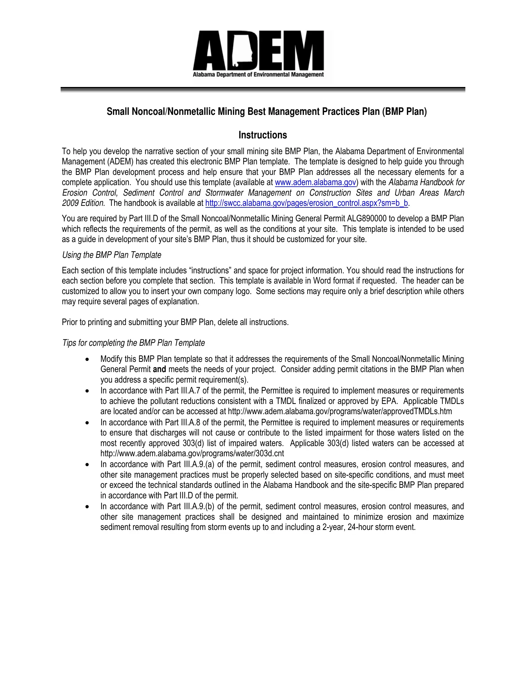
2. The subsequent step is usually to submit these blanks: Contents SECTION SITE EVALUATION.

plan bmp sample conclusion process detailed (stage 2)

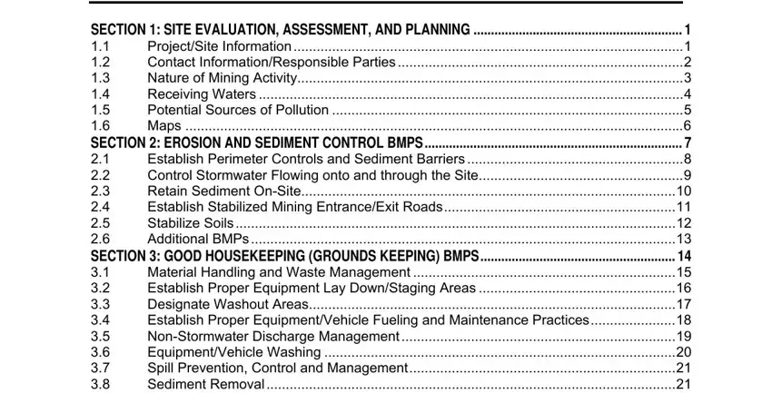
Be very mindful when completing Contents SECTION SITE EVALUATION and Contents SECTION SITE EVALUATION, as this is where most people make some mistakes.

3. This 3rd part should also be fairly easy, Contents SECTION SITE EVALUATION - all of these blanks will have to be completed here.

Contents SECTION  SITE EVALUATION, Contents SECTION  SITE EVALUATION, and Contents SECTION  SITE EVALUATION of plan bmp sample

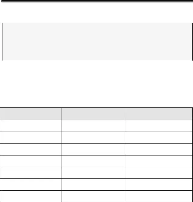
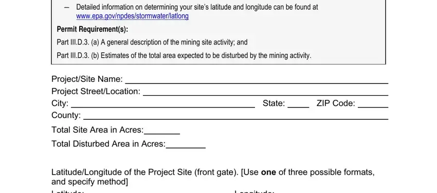
4. This next section requires some additional information. Ensure you complete all the necessary fields - Detailed information on, wwwepagovnpdesstormwaterlatlong, Permit Requirements, Part IIID a A general description, Part IIID b Estimates of the total, ProjectSite Name Project, Total Site Area in Acres, Total Disturbed Area in Acres, State, ZIP Code, LatitudeLongitude of the Project, Latitude, and Longitude - to proceed further in your process!

Simple tips to fill out plan bmp sample step 4

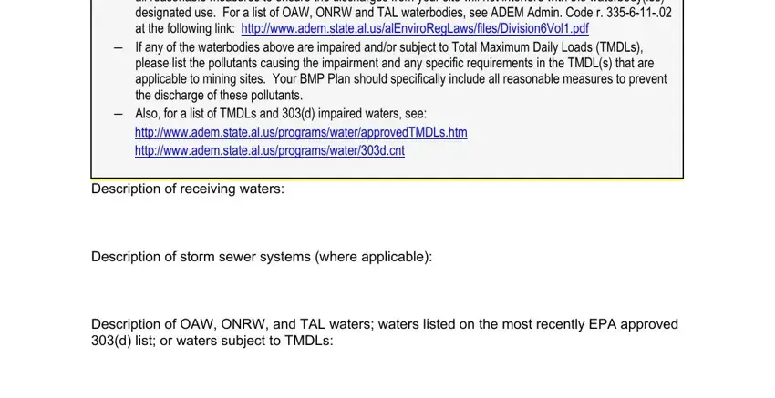
5. To conclude your document, the last area has several extra fields. Filling in Resource Waters ONRW or Treasured, If any of the waterbodies above, please list the pollutants causing, Also for a list of TMDLs and d, Description of receiving waters, Description of storm sewer systems, and Description of OAW ONRW and TAL should finalize everything and you're going to be done in a short time!

The best ways to fill in plan bmp sample stage 5

Step 3: Immediately after proofreading the form fields, click "Done" and you're done and dusted! After registering a7-day free trial account at FormsPal, you will be able to download bmp plan template or email it directly. The PDF document will also be at your disposal in your personal account menu with all of your changes. FormsPal guarantees risk-free document tools without personal data recording or any type of sharing. Rest assured that your information is secure here!