Applications must be computer generated online, typewritten, or printed in BLACK or BLUE INK. ALL ITEMS in the application must be completed. Incomplete applications may be returned for more information. Applications are evaluated in chronological order. Please allow approximately six weeks for processing.
This form may be reproduced by photocopying. Reproductions must retain margins and print quality of the original form. If filing online see online filing instructions! You may also save, print, scan and email the completed form to: dwrpermitsonline@state.co.us
DO NOT use this form for the registration of an existing well in use prior to May 8, 1972; (use Form GWS-12).
FEES: This application must be submitted with the appropriate filing fee. The filing fee for applications is $100. Exceptions are as follows:
1)An application to replace or deepen an existing permitted well that is in the same source (aquifer) which does not have a “-F” or “-R” suffix after the original permit number is $60. 2) Applications to register an existing well (use Form GWS-12), and replace or deepen the well (use Form GWS-44) into the same aquifer is $100 if submitted together. Fees are nonrefundable. Acceptable forms of payment are check or money order, payable to the Colorado Division of Water Resources. Payment by Visa, MasterCard or Discover cards can be accepted by phone through the Records Office at 303.866.3581.
USES: This form (GWS-44) is to be used when applying for a permit for the following types of uses:
A.Ordinary household use inside one single-family dwelling (NO outside water use allowed): Generally, this is all that can be approved on parcels less than 35 acres.
B.Ordinary household use in 1 to 3 single-family dwellings, irrigation of up to one acre of home garden and lawn, and watering of domestic animals: Generally, permits can be approved on parcels of land of 35 or more acres, or in areas inside the Designated Basins, the Denver Basin, limited areas on the Western Slope, and for subdivisions under a court- approved plan for augmentation that allow outside uses.
C.Livestock watering on farm, ranch, range, or pasture (on parcels of 35 or more acres).
ITEM INSTRUCTIONS: (numbers correspond with those on the front of this form)
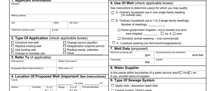
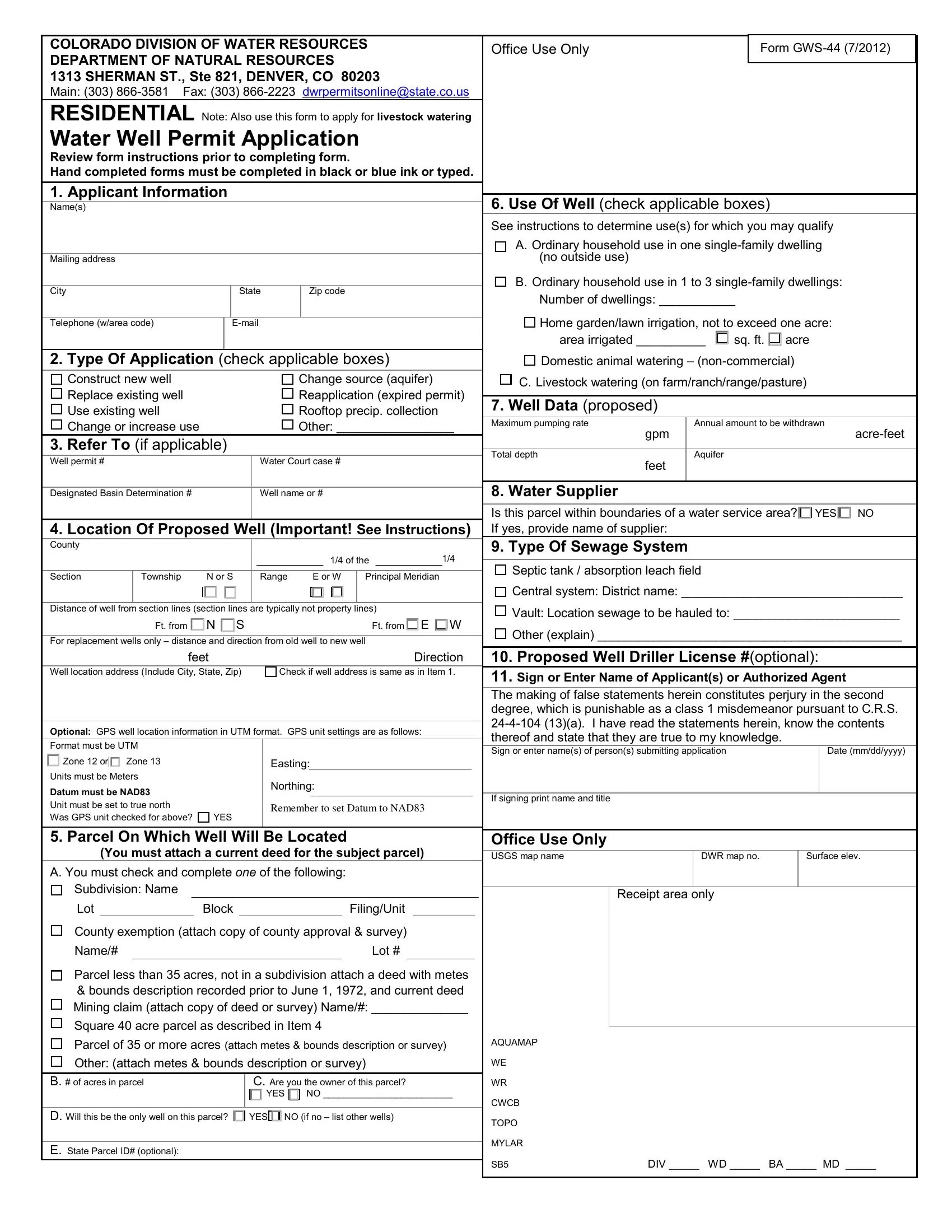
1.The applicant is the entity for whom the permit is to be issued. Since the well owner is ultimately responsible for the use of the well, their name should be in this area. The mailing address is where the applicant currently receives mail.
2.Check all boxes that apply. If you check the box for Rooftop precip. collection, you must also complete and submit Form No. GWS-78.
3.Complete all boxes that apply.
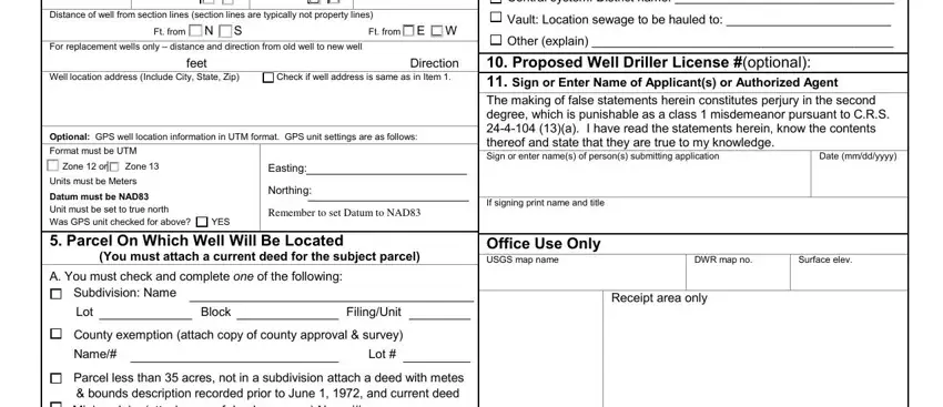
4.You must provide a well spot location under the following circumstances: (a) the location is decreed by a water court; (b) the well will be inside the Denver Basin or other location where a site- specific well depth restriction will apply; (c) your application is for a permit to use an existing well. When a spot location is required, you must provide the county, ¼ of the ¼ section designation (example: NE ¼ of the SE ¼), section #, township, range, principal meridian, and either distances from section lines or a GPS location (UTM coordinates). If providing a GPS location, the required GPS unit settings must be as indicated on this form. Colorado contains two UTM zones (12 & 13). Zone 13 covers most of
Colorado. The boundary between Zone 12 and Zone 13 is the 108th Meridian (longitude). West of the 108th Meridian is UTM Zone 12 and east of the 108th Meridian is UTM Zone 13. The 108th Meridian is approximately 57 miles east of the Colorado- Utah state line. On most GPS units, the UTM zone is given as part of the Easting measurement, e.g. 12T0123456. Check the appropriate box for the zone.
For all other applicants, you must provide the following minimum information: (a) the county, section #, township, range and principal meridian; and, (b) the subdivision lot, block & filing/unit designations as applicable if in a subdivision. You do
not need to provide distances from section lines or a GPS location (UTM coordinates).
Provide the property address of the well location if one exists. If it is the same as the mailing address, check the box next to the well location address.
5.A current deed for the subject parcel must be attached. If the
subject parcel is 35 or more acres, a complete metes and bounds type legal description or surveyor’s plat map that references a section point is required to enable us to plot the parcel in our mapping system. If the parcel is less than 35 acres and not in a subdivision, a deed with metes and bounds legal description, recorded prior to June 1, 1972 is required. Complete Items 5A through 5E (5E is optional). If you answered NO to Item 5C please indicate who the landowner is. If you are under a contract to purchase the subject property, please state this as well. If the parcel is inside the Denver Basin, the application must be in the name of and signed by, or their name entered by, the current landowner. If filing online please see online filing instructions for how to submit deed and or legal description attachments.
6.See above comments under USES to determine those uses for which you may qualify, and then check the applicable box or boxes.
7.The maximum pumping rate is limited to 15 gpm for most residential type well permits. The annual amount of water to be withdrawn is a volume measured in acre-feet. One acre-foot equals 325,851 gallons. For ordinary household use inside one single-family dwelling and no outside use, the annual amount will be about 1/3 acre-foot. For ordinary household use in three single-family dwellings, one acre of home garden/lawn irrigation, and watering of domestic animals, the annual amount will be about 3 acre-feet. For 100 head of livestock, the annual amount will be about 1.35 acre-feet. Please indicate the estimated depth of the proposed well. The proposed aquifer for the well must be indicated if the well is to be located within the Denver Basin (the approximate area of the Denver Basin extends south from Greeley to an area east of Colorado Springs and from Golden east to Limon), the San Luis Valley, the Southern High Plains basin in Baca or Prowers Counties, or in areas where it is believed the well will penetrate a confining layer. Aquifer information should be provided if known, for well locations outside of these areas.
8.The issuance of well permits may depend on the availability of another source of water, pursuant to CRS 37-92-602(6), such as water from a municipality or water district. (Statutes can be accessed through the CDWR web site.)
9.Check the applicable box, and complete or attach any additional information as requested in this item.
10.Wells must be constructed by a Colorado licensed well driller, or under the “private driller” provision as defined in CRS 37-91- 102(12). A listing of licensed well drillers/pump installers is
availableat http://water.state.co.us/groundwater/BOE/Pages/LicensedContract ors.aspx
11.The individual signing the application or entering their name (and title if applicable) must be the applicant or an officer of the corporation/company/agency identified as the applicant or their attorney. An authorized agent may also sign or enter their name on the application if a letter signed by the applicant or their
attorney is submitted with the application authorizing that agent to sign or enter their name on the applicant’s behalf. Payment must be received via phone if filing online at 303.866.3581 (Records Office) prior to processing the application.
IF YOU HAVE ANY QUESTIONS please call the Colo. Division of Water Resources (303-866-3581), or the nearest Division Field Office in Greeley (970-352-8712), Pueblo (719-542-3368), Alamosa (719-589-6683), Montrose (970-249-6622), Glenwood Springs (970-945-5665), Steamboat Springs (970-879-0272), or Durango (970-247-1845), or refer to the CDWR web site at http://www.water.state.co.us for general information, additional forms, and access to state rules or statutes.


