Ifr Navigation Log Form PDF Details

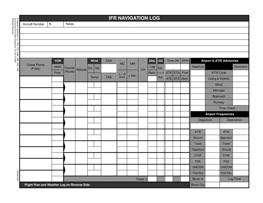
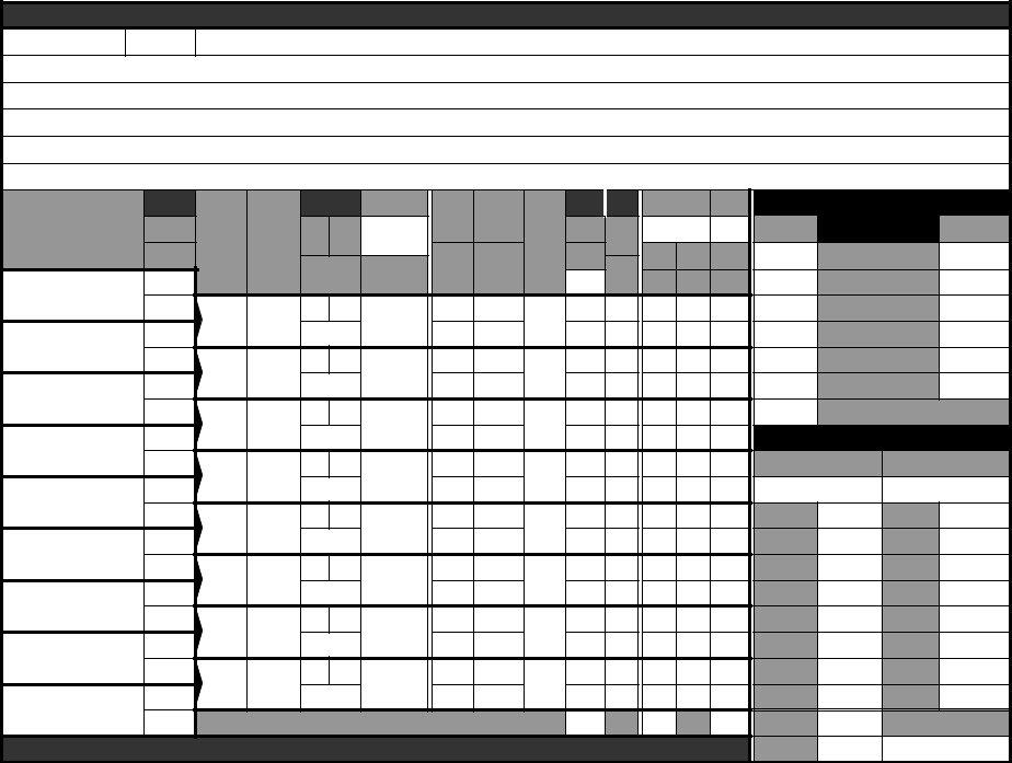
The IFR Navigation Log form, meticulously developed by Jeppesen Sanderson since 1974, serves as an indispensable tool for aviators navigating the intricacies of instrument flight rules (IFR) flying. Located at 55 Inverness Drive East, Englewood, CO, the company has consistently updated this critical document to address the evolving needs of pilots. This comprehensive form captures essential data ranging from aircraft number, departure and destination airports, to detailed flight and weather logs, ensuring a well-planned and safe flight under IFR conditions. It meticulously records every aspect needed for a successful journey, including airspeeds, altitudes, estimated and actual times enroute (ETE/ETA), fuel consumption, and navigational checkpoints. Additionally, it encompasses weather forecasts, ceiling, visibility, winds aloft, and other considerable atmospheric conditions, critical for pre-flight planning and in-flight adjustments. The form also integrates flight plan information, such as aircraft type, pilot details, route, and emergency contact information, making it an all-encompassing tool for flight preparation and execution. Pilots rely on this log for maintaining situational awareness and ensuring regulatory compliance, evidencing its irreplaceable role in the safety and efficiency of air navigation.

QuestionAnswer
Form NameIfr Navigation Log Form
Form Length2 pages
Fillable?Yes
Fillable fields300
Avg. time to fill out30 min 15 sec
Other namesifr log, ifr navigation log, jeppesen ifr nav log, flight plan log

Form Preview Example

AllRightsReserved

55InvernessDriveEast,

©JeppesenSanderson,


IFR NAVIGATION LOG


Aircraft Number

N

Notes


Englewood, CO

Inc. 1974, 1977,


80112-5498

1982, 1989,1993,


VOR


Wind

CAS


Dist.

GS

Time Off

GPH

Airport & ATIS Advisories


Check Points


MC

MH


Ident


Leg


Departure


Destination


1996

(Fixes)

Course


Dir. Vel.


Est.


Altitude


CH


Freq.

(Route)


ETE ETA

Fuel


ATIS Code


-L / +R

Rem.


± Dev.


Temp

TAS

WCA

Act.


ATE ATA Rem.


Ceiling & Visibility


Wind


Altimeter


Approach


Runway


Time Check


Airport Frequencies


Departure

Destination


ATIS


ATIS


Ground


Approach


Tower


Tower


Departure


Ground


CTAF


CTAF


FSS


FSS


MU436183H


UNICOM


UNICOM


Totals »


Block In


Log Time


Field Elev


Field Elev


Flight Plan and Weather Log on Reverse Side


Block Out


WEATHER LOG

Ceiling, Visibility and Precipitation

Reported

Forecast


Winds Aloft

Icing

and Freezing Level

Turbulence

and Cloud Tops

Position of Fronts,

Lows and Highs

Departure

Enroute

Destination

Alternate

FLIGHT PLAN


1.

Type

2. Aircraft

3. Aircraft Type/


4. True

5. Departure

6. Departure Time

7.Cruising


VFR

Identification

Special Equipment

Airspeed

Point


Proposed (Z)

Actual (Z)

Altitude


IFR


DVFR


Knots


8. Route of Flight


9. Destination (Name of airport and city)

10. Est. Time Enroute

11. Remarks


Hours


Minutes


12. Fuel on board

13. Alternate Airport(s)


14. Pilot's Name, Address, Tel # & Aircraft Home Base

15. # Aboard


Hours

Minutes


16. Color of Aircraft


17. Destination Contact / Telephone (Optional)


CLOSE VFR FLIGHT PLAN WITH _____________________ FSS ON ARRIVAL


Special Equipment Suffix


/C-RNAV, transponder with no altitude encoding


capability


/X-No Transponder


/B-DME, transponder with no altitude encoding capability

/W-RNAV, no transponder


/T-Transponder with no altitude encoding capability

/A-DME, transponder with altitude encoding capability

/G-Global Positioning System (GPS)/Global


/U-Transponder with altitude encoding capability

/R-RNAV, transponder with altitude encoding capability

Navigation Satellite System (GNSS) equipped


/D-DME, no transponder


aircraft with ocianic, enrout, terminal, and GPS


approach capability.


Notes and NOTAMs

Position Report

Acft.

Position

Time

Alt.

IFR/

Est.

Name

Ident.

VFR

Next Fix

Following Fix


Report Conditions Aloft - Cloud Tops, Bases, Layers, Visibility, Turbulence, Haze, Ice, Thunderstorms

How to Edit Ifr Navigation Log Form Online for Free

Due to the objective of making it as effortless to use as it can be, we created our PDF editor. The whole process of preparing the ifr navlog can be quick should you comply with the next steps.

Step 1: Choose the "Get Form Here" button.

Step 2: The form editing page is currently available. Include text or modify present data.

For each part, add the details requested by the software.
log flight plan fields to fill out

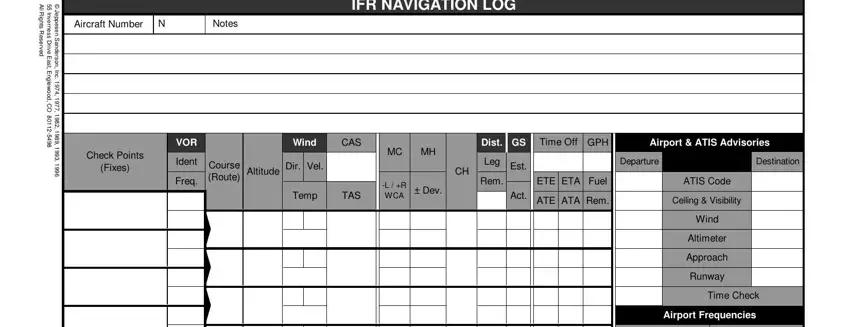
You have to prepare the Departure, Destination, AT, IS Ground, Tower, Departure, C, TAF FS, S UNICO, M Field, E, lev Block, In Block, Out AT, IS Approach, and Tower area with the essential data.

step 2 to filling out log flight plan

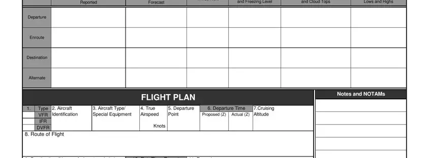
Note the significant data when you are on the Reported, Forecast, Winds, Aloft and, Freezing, Level and, Cloud, Tops Lows, and, Highs Departure, En, route Destination, Alternate, Type, VFR, IFR D, VFR FLIGHT, PLAN Notes, and, NOT, AMs and Aircraft, Identification segment.
Filling in log flight plan stage 3

Inside the section Destination, Name, of, airport, and, city Est, Time, En, route Remarks, Hours, Minutes, Fuel, onboard Alternate, Airports Aboard, Hours, Minutes, Color, of, Aircraft Destination, Contact, Telephone, Optional CLOSE, VFR, FLIGHT, PLAN, WITH, FS, SON, ARRIVAL Position, Report and Special, Equipment, Suffix write down the rights and responsibilities of the sides.

Finishing log flight plan stage 4

Step 3: Click the "Done" button. At that moment, you can transfer your PDF document - save it to your device or forward it by using email.

Step 4: You can make copies of your form toprevent any kind of future complications. You should not worry, we don't publish or record your data.
Watch Ifr Navigation Log Form Video Instruction

Please rate Ifr Navigation Log Form

1 Votes
If you believe this page is infringing on your copyright, please familiarize yourself with and follow our DMCA notice and takedown process - click here to proceed .