
Completing the AIS programming form requires information from your FCC Ships Station License, MMSI registration, and vessel documents. Follow these steps to fill it out correctly before giving the form to your marine electronics technician.
Step 1: Gather required documents
Collect your FCC Ships Station License, MMSI registration confirmation from BoatUS or Sea Tow, and the vessel official documentation or state registration. These documents contain the exact vessel name, MMSI number, and call sign needed for accurate AIS programming. Keep copies of these documents in your vessel documentation folder.
Step 2: Enter vessel identification data
Write the vessel name exactly as it appears on your FCC license or state registration. Enter the nine-digit MMSI number without spaces or hyphens. Add the FCC call sign if one has been issued. Recreational vessels without an FCC license may leave the call sign field blank.
Step 3: Select the vessel type code
Choose the numeric vessel type code that matches your craft. Common codes include 36 for sailing vessels, 37 for pleasure craft, 30 for fishing vessels, and 31 or 32 for towing vessels. Enter this code in the vessel type field on the AIS programming form.
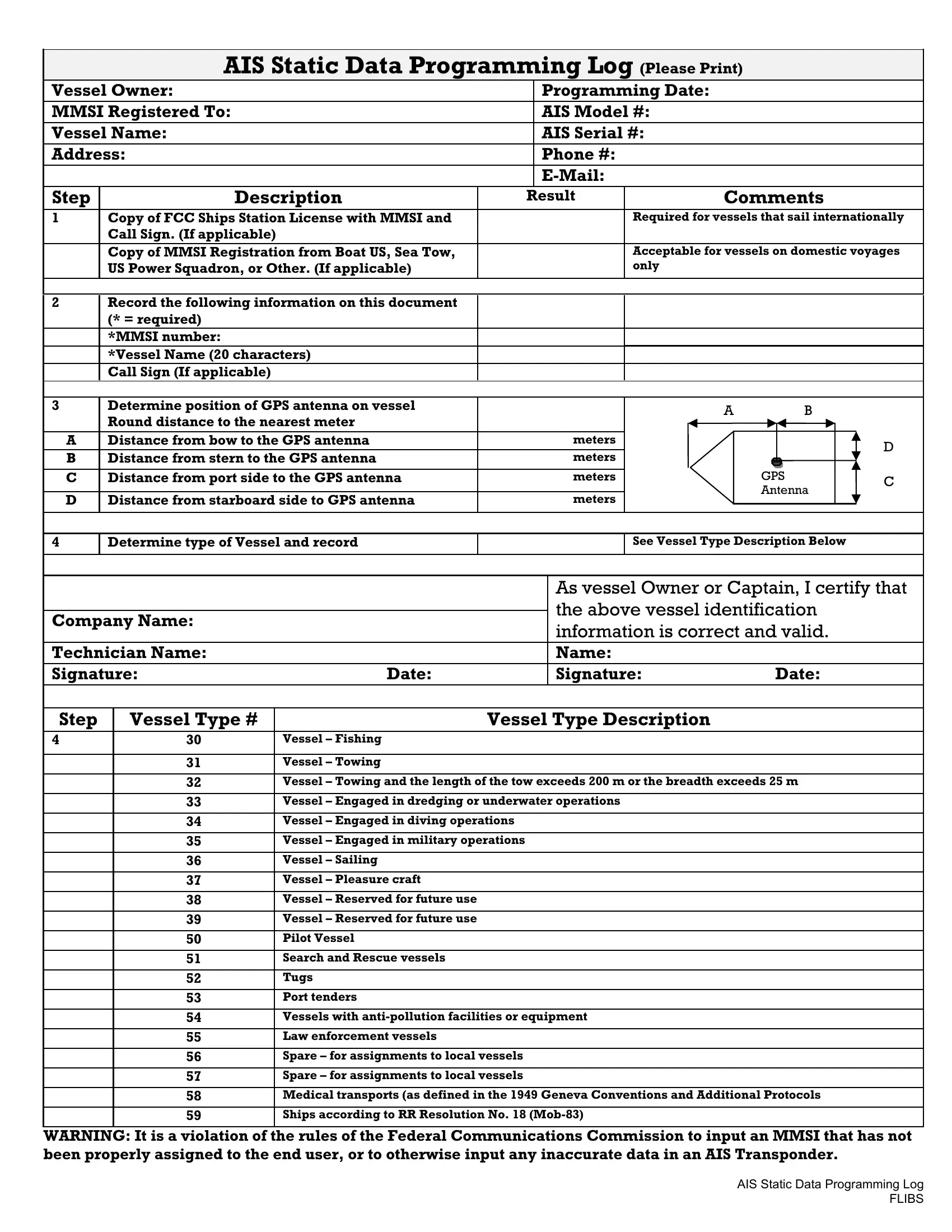
Step 4: Record GPS antenna position
Measure the GPS antenna position in meters from the vessel reference point. Record the distance from the bow (A), from the stern (B), from the port side (C), and from the starboard side (D). Accurate positioning helps other vessels see a precise AIS target on their chart plotters and radar displays.
Step 5: Submit the completed form
Hand the completed AIS programming form to the marine electronics technician who will configure your transponder. Keep a copy alongside your maritime documents and FCC license. For vessels making international voyages, confirm the FCC Ships Station License number is recorded before departure.
Vessel owners may also need a Merchant Mariner Oath form for crew documentation or an IFR navigation log form for voyage record-keeping.