The FEMA 086 0 22 form is a crucial document for property owners in areas prone to flooding and administered by the Department of Homeland Security’s Federal Emergency Management Agency (FEMA). It serves a specialized purpose: to facilitate the amendment of National Flood Insurance Program Maps for single residential lots or structures. This form essentially allows property owners to request a Letter of Map Amendment (LOMA), which can remove a structure or a parcel of land from a designated Special Flood Hazard Area (SFHA) without the need for physical alterations to the property. The SFHA designation indicates areas with a high risk of flooding, which significantly affects insurance premiums and property development potential. Completion of this form, which requires detailed property descriptions, legal documentation, and certified elevation data, hinges on the assertion that no fill has been used to artificially raise the property's elevation. The paperwork burden associated with this process is estimated at 2.4 hours, underscoring the complexity and detailed nature of the submission. Furthermore, the application emphasizes the need for accuracy and completeness to avoid processing delays, highlighting FEMA's stringent criteria for map amendments. It’s a critical process for property owners who wish to challenge their property's flood zone designation, potentially leading to lower insurance costs and fewer development restrictions.
| Question | Answer |
|---|---|
| Form Name | Fema Form 086 0 22 |
| Form Length | 3 pages |
| Fillable? | No |
| Fillable fields | 0 |
| Avg. time to fill out | 45 sec |
| Other names | fema form 086 0 22, fema mt ez form, fema 0 22 form, fema ez form |
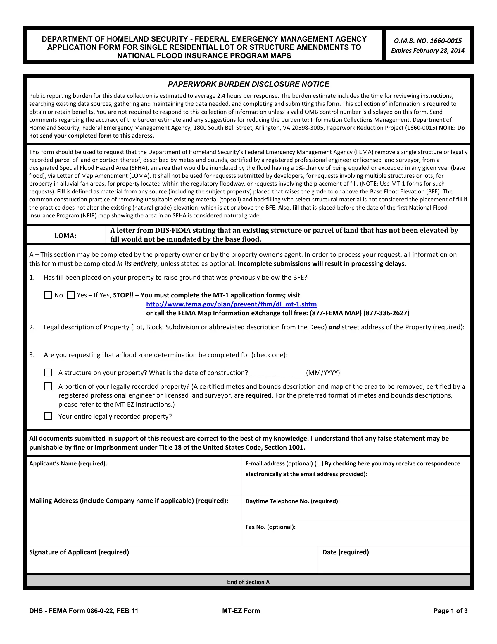
DEPARTMENT OF HOMELAND SECURITY - FEDERAL EMERGENCY MANAGEMENT AGENCY APPLICATION FORM FOR SINGLE RESIDENTIAL LOT OR STRUCTURE AMENDMENTS TO NATIONAL FLOOD INSURANCE PROGRAM MAPS
O.M.B. NO.
Expires February 28, 2014
PAPERWORK BURDEN DISCLOSURE NOTICE
Public reporting burden for this data collection is estimated to average 2.4 hours per response. The burden estimate includes the time for reviewing instructions, searching existing data sources, gathering and maintaining the data needed, and completing and submitting this form. This collection of information is required to obtain or retain benefits. You are not required to respond to this collection of information unless a valid OMB control number is displayed on this form. Send comments regarding the accuracy of the burden estimate and any suggestions for reducing the burden to: Information Collections Management, Department of Homeland Security, Federal Emergency Management Agency, 1800 South Bell Street, Arlington, VA
This form should be used to request that the Department of Homeland Security’s Federal Emergency Management Agency (FEMA) remove a single structure or legally recorded parcel of land or portion thereof, described by metes and bounds, certified by a registered professional engineer or licensed land surveyor, from a designated Special Flood Hazard Area (SFHA), an area that would be inundated by the flood having a
LOMA:
A letter from
A – This section may be completed by the property owner or by the property owner’s agent. In order to process your request, all information on this form must be completed in its entirety, unless stated as optional. Incomplete submissions will result in processing delays.
1.Has fill been placed on your property to raise ground that was previously below the BFE?
No
Yes – If Yes, STOP!! – You must complete the
or call the FEMA Map Information eXchange toll free:
2.Legal description of Property (Lot, Block, Subdivision or abbreviated description from the Deed) and street address of the Property (required):
3.Are you requesting that a flood zone determination be completed for (check one):
A structure on your property? What is the date of construction? _______________ (MM/YYYY)
A portion of your legally recorded property? (A certified metes and bounds description and map of the area to be removed, certified by a registered professional engineer or licensed land surveyor, are required. For the preferred format of metes and bounds descriptions, please refer to the
Your entire legally recorded property?
All documents submitted in support of this request are correct to the best of my knowledge. I understand that any false statement may be punishable by fine or imprisonment under Title 18 of the United States Code, Section 1001.
Applicant’s Name (required):
Mailing Address (include Company name if applicable) (required):
Daytime Telephone No. (required):
Fax No. (optional):
Signature of Applicant (required)
Date (required)
END OF SECTION A
DHS - FEMA Form |
Page 1 of 3 |
B – This section must be completed by a registered professional engineer or licensed land surveyor. Incomplete submissions will result in processing delays.
NOTE: If the request is to have a flood zone determination completed for the structure, and an Elevation Certificate has been completed for this property, it may be submitted in lieu of Section B. If the request is to have a flood zone determination completed for the entire legally recorded property, or a portion thereof, the lowest elevation on the lot or described portion must be provided in Section B.
Applicable Regulations
The regulations pertaining to LOMAs are presented in the National Flood Insurance Program (NFIP) regulations under Title 44, Chapter I, Parts 70 and 72, Code of Federal Regulations. The purpose of Part 70 is to provide an administrative procedure whereby
Basis of Determination
Determination Requested For: (check one) |
Elevation Information Required: (complete Item 5) |
|
Structure located on natural grade (LOMA) |
Lowest Adjacent Grade to the structure (the elevation of the lowest ground |
|
touching the structure including attached patios, stairs, deck supports or garages) |
||
|
||
|
|
|
Legally recorded parcel of land, or portion thereof (LOMA) |
Elevation of the lowest ground on the parcel or within the portion of land to be |
|
removed from the SFHA |
||
|
||
|
|
1. PROPERTY INFORMATION
Property Description (Lot and Block Number, Tax Parcel Number, or Abbreviated Description from the Deed, etc.):
2. STRUCTURE INFORMATION
Street Address (including Apt. Unit, Suite, and/or Bldg. No.):
What is the type of construction? (check one)
other (explain):
crawl space
slab on grade
basement/enclosure
3. GEOGRAPHIC COORDINATE DATA
Please provide the Latitude and Longitude of the most upstream edge of the structure (in decimal degrees to nearest fifth decimal place)
Indicate Datum: WGS84 |
NAD83 |
NAD27 Lat. |
. |
Long. |
. |
Please provide the Latitude and Longitude of the most upstream edge of the property (in decimal degrees to nearest fifth decimal place)
Indicate Datum: WGS84 |
NAD83 |
NAD27 Lat. |
. |
Long. |
. |
|
|
|
|
||
4. FLOOD INSURANCE RATE MAP (FIRM) INFORMATION |
|
|
|
||
NFIP Community Number: Map Panel Number:
Base Flood Elevation (BFE):
Source of BFE:
5. ELEVATION INFORMATION (SURVEY REQUIRED)
• |
Lowest Adjacent Grade (LAG) to the structure (to the nearest 0.1 foot or meter) |
|
. |
ft. (m) |
|
|
|
|
• |
Elevation of the lowest grade on the property; or within metes and bounds area (to the nearest 0.1 foot or meter) |
. |
ft. (m) |
|||||
• |
Indicate the datum (if different from NGVD 29 or NAVD 88 attach datum conversion) |
NGVD 29 |
NAVD 88 |
Other (add attachment) |
||||
• |
Has FEMA identified this area as subject to land subsidence or uplift? |
No |
Yes (provide date of current releveling): |
|
||||
This certification is to be signed and sealed by a licensed land surveyor, registered professional engineer, or architect authorized by law to certify elevation information. All documents submitted in support of this request are correct to the best of my knowledge. I understand that any false statement may be punishable by fine or imprisonment under Title 18 of the United States Code, Section 1001.
Certifier’s Name:
Company Name:
Email:
Signature:
License No.: |
Expiration Date: |
Telephone No.: |
Fax No.: |
|
|
Date:
Seal (optional)
DHS - FEMA Form |
Page 2 of 3 |
In addition to this form
Copy of the effective FIRM panel on which the structure and/or property location has been accurately plotted
Copy of the Subdivision Plat Map (with recordation data and stamp of the Recorder’s Office)
OR
Copy of the Property Deed (with recordation data and stamp of the Recorder’s Office), accompanied by a tax assessor’s map or other certified map showing the surveyed location of the property relative to local streets and watercourses. The map should include at least one street intersection that is shown on the FIRM panel.
Please include a map scale and North arrow on all maps submitted.
Please do not submit original documents. Please retain a copy of all submitted documents for your records.
Incomplete submissions will result in processing delays. For additional information regarding this form, including where to obtain the supporting documents listed above, please refer to the
Mail your request to:
LOMC CLEARINGHOUSE
7390 COCA COLA DRIVE, SUITE 204
HANOVER, MD 21076
Attn.: LOMA Manager
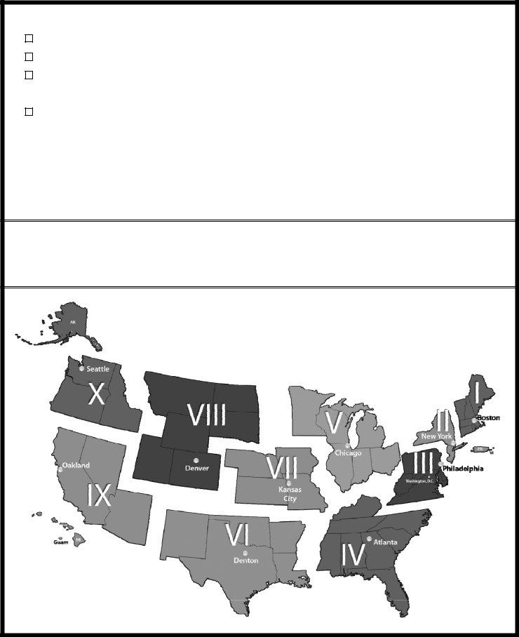
FEMA REGIONS
DHS - FEMA Form |
Page 3 of 3 |